Regional Overview of North Africa and Southwest Asia
There are 20 countries in this region:
Saudi Arabia, Sudan, Oman, United Arab Emirates, Iran, Iraq, Turkey, Syria, Libya, Algeria, Morocco, Bahrain, Kuwait, Israel, Qatar, Egypt, Tunisia, Jordan, Lebanon, Yemen
Physical Features
Feature 1
Atlas Mountains
The Atlas mountains are located in Morocco, Algeria and Tunisia. The highest point is Jbel Toubkal at 13,670 feet. The range stretches 1,550 miles across North Africa. The range separates the Mediterranean and the Atlantic coastlines from the Sahara desert. They are home to numerous plant and animal species and many of them are endangered. The mountain range is rich in natural resources of iron ore, lead ore, copper, silver, phosphate, marble, coal and gas. (Pulsipher & Pulsipher, 2008)
Feature 2
Libyan Desert
The Libyan Desert covers 500,000 miles in Libya, Egypt, and Sudan. Elevations vary from 500 to 3,000feet in the Northeast, in Egypt, to more than 400 feet below sea level in the lowest points in Africa. The arid climate is extremely dry and the area can go years without any recorded rainfall. The terrain is made up of plains, rocks and sand dunes. The area experienced intense fighting during World War II. (Britannica, 2009)
Feature 3
Nile River
The Nile is the longest river in the world. It is over 4,100 feet long and flows north in North Africa. The Nile has two main tributaries, the White Nile and the Blue Nile. It runs through the countries of Ethiopia, Sudan, Egypt, Uganda, Democratic Republic of the Congo, Burundi, Rwanda, Kenya and Tanzania. Its coordinates are 12'16'09"N and 037'15'53"E. The river ends in a large delta that empties into the Mediterranean Sea. The Nile is a water source for the countries of North Africa but has caused much discord int he region. Uganda, Sudan, Ethiopia, and Kenya have complained about Egypt's dominance over the waters of the Nile. (Nile Basin Initiative, 2011)
Feature 4
Ahaggar Mountains
This mountain range is located in Algeria along the Tropic of Cancer. Its coordinates are 23'17'0"n and 05'31'0"E. The highest point is Mount Tahat with an elevation of 9,852 feet. The range is composed of volcanic rock and has a hot summer climate and cold winter climate. Rainfall in the mountain range is rare. The mountains serve a religious significance in this area. The tomb of Tin Hinan, the god believed to be the ancestor of the Tuareg is located in the mountains. (World Geography, 2010)
Feature 5
Nubian Desert
The Nubian Desert is located in northeastern Sudan and is separated from the Libyan Desert by the Nile River valley to the west, Egypt to the north and from the Red Sea in the east. The Nubian Desert is rocky and rugged. It has an arid climate and is mostly a large sandstone plateau. There is hardly any rainfall in this desert, an average of 5 inches per year. (Brittanica, 2011)
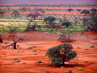
Climate:
There is no other in the region as dry as North Africa. The landscape is made up of mostly desert with arid and semiarid climates. The temperatures can be extremely hot during the day reaching 130 degrees farenheit during midday. The nighttime temperatures in this region can drop below freezing at night. (Pulsipher & Pulsipher, 2008)
Resources:
Resource1-Oil
This region contains the world's largest oil reserves and they are located mainly in the Persian Gulf. Europe and North America were the first countries to exploit these resources until local governments were able to take control in the 1970's. Rising cost of oil is linked to the demand and production time of this region. Most of the world's oil comes from these reserves and the local economy is based on the production and selling of oil. Many people have become wealthy in this region form the oil economy. (Pulsipher & Pulsipher, 2008)
Resource 2 Herding
Herding was the economic mainstay in this region for thousands of years. Sheep and camels are the two main animals that were herded. The importance of herding has been in decline since the construction of railroads and highways in North Africa. Herding sheep is still a common practice in this region as there is a high demand for sheep's wool. Many of the nomadic herders who relied on this for their means of living have lost income due to modernization. (Pulsipher & Pulsipher, 2008)
Environmental Issues:
Issue 1-Water Availability
Because this region of the world is such an arid (dry) climate, water resources are hard to come by. People in this region use very little water in their daily life and usually have to walk great distances to retrieve it. Modernization is putting further strain on the water resources as plumbing, cooling and cleaning and industrial irrigation systems require its use. Another strain on this resource is the expanding population. The biggest use of this resource is for irrigation. Efforts to increase this resource are being made in the region. Water recycling is becoming more widely used and dams and reservoirs are being constructed on the major river systems. (Pulsipher & Pulsipher, 2008)
Issue2-Desertification
Desertification is the ecological changes that convert nondesert lands into deserts. The changes include loss of vegetation and soil moisture, erosion of the land by winds and the formation of sand dunes. One of the possibilities for the changing landscape could be human influenced by our creation of greenhouse gases and the overuse of resources depleting the lands. In this region herders are often blamed for allowing large herd of animals to graze the vegetation of the land. Without this vegetation the soil is not able to retain moisture giving way to sand. Studies are examining whether or not this is this case as many herders have been shown to not allow their herds to overgraze the lands. Irrigation could be another cause to this problem as water is in such scarce supply it is irrigated wherever possible to urban areas. Moisture no longer reaches plant roots killing them off. (Pulsipher & Pulsipher, 2008)
Population Patterns:
The most densely populated area in this region is in the city of Cairo with over 2600 million people per square mile. Though this region is vast a majority of it is uninhabitable by people because of the dryness and lack of water. The areas populated are mostly on the coastal region. This region became populated between 10,000 and 18,000 years ago by nomadic people who founded agricultural communities. This region's population grew as more of this settlements were created and with the spreading of religion. (Pulsipher & Pulsipher, 2008)
Role of Gender:
In the early history of this region families were small and men and women performed similar chores. With the emergence of wealth in the area because of the excavation of the resources of the land women became seen as property of men. The reason for this control was that inheritance became a big concern for families and they felt that the women's body needed to be controlled to prevent premarital pregnancy. Families in rural communities have a high number of children because they are expected to work the land and the labor is needed. Women in the city have the opportunity to work and so they have fewer children. The culture in this region holds a preference for men. Men have more status financially, politically and socially. They earn bigger incomes and hold more powerful, prestigious jobs than women in the workforce. (Pulsipher & Pulsipher, 2008)
Religions:
Religion 1-Islam
Islam is the dominating religion is North Africa and Southwest Asia. Islam is a monotheistic religion that has its origins in the Mediterranean. The faith was spread by the Bedouin nomads of the Arabian peninsula and it controls both politics and trade in the region. Its cultural practices are complicated and often misunderstood because the people of this region tend to fuse their own ancestral beliefs to the practices. (Pulsipher & Pulsipher, 2008)
Religion 2-Judaism
Judaism was founded approximately 4000 years ago. The patriarch of this religion was called Abraham who led followers through Mesopotamia to the eastern Mediterranean. The Jewish religion was recorded in the Torah, which is the Old Testament of the Bible. Diaspora was the dispersion of people following the Jewish revolt against the Roman Empire. (Pulsipher & Pulsipher, 2008)
Transportation:
The vast deserts of this region are a barrier to transportation in this region. Waterways are used where they are easily accessible between villages and most people of this region travel by foot. A railway system is in development in portions of the region. (Pulsipher & Pulsipher, 2008)
Agriculture:
Today agriculture is only possible in a few locations in this region. The overuse of soils and irrigation as well as climate changes have led to the lessening of agricultural production. The Mediterranean coast is used by farmers to grow fruits, grapes, olives, and vegetables during the winter months when rain is more plentiful. In the valleys of the major river systems cotton, wheat, barley and vegetables can grow because of seasonal flooding and irrigation. Animals graze where it is possible throughout the oases of the region and in these location some crops such as melons, dates and apricots can grow. (Pulispher & Pulsipher, 2008)
Country of Focus:
Morocco
Morocco is located in North Africa and has a population of over 32 million people. Its capital is Rabat and its largest city is Casablanca. The official language of Morocco is Arabic. Arabs make up over 99 percent of the country's population. Morocco is a monarchy. The King makes executive decisions and parliament is the legislative branch of Morocco's government. The country is 274,000 square miles. Morocco is bordered by the Mediterranean Sea and the Atlantic ocean. Spain is bordered on the north. The country sits between 27' and 36' N and 1' and 14' W. A large part of this region is mountainous. The Rif Mountains are located in the north and the Atlas are in the center and south. Algeria borders Morocco to the east and southeast but the border is closed between the two countries. The climate of this region is Mediterranean in the north and Temperate in the mountains. Morocco's economy relies on its export of phosphates. It is the world's largest exporter of phosphates and its price fluctuations in the international market influence Morocco's economy strongly. The services sector accounts for just over half of Morocco's GDP and industry makes up another quarter. This country relies heavily on agriculture. The GDP varies because of the inconsistent rain in this region which the country's crops rely on. Transportation is mainly the railway system. The Tangier-Casablance high-speed rail system is the beginning of an extensive and expansive railway system that is currently being developed. It is expected to be completed in 2035 and carry 8 million passengers per year. Morocco is the second most populated Arab country after Egypt and the country is culturally diverse. The country has a very diverse cuisine. It is a mix of Berber, Spanish, Corsican, Moorish, Mediterranean and African. Spices are used extensively and many of the spices used are imported. (Encarta, 2009)
Resources:
Pulsipher, A. & Pulsipher, L. (2008) World Regional Geography: Global Patterns, Local Lives (4th Edition) New York: W.H. Freeman Company
Encarta Encyclopedia. (2009) Morocco. Retrieved from: http://encarta.msn.com/encyclopedia/Morocco.html
Encyclopedia of Britannica. (2011). Nubian Desert. Retrieved from: http://www.britannica.com/EBchecked/topic/.421505/Nubian-Desert
World Geography. (2010). Sahara. Retrieved from: http://www.world-geography.org/12-ahaggar-mountains.html
Encyclopedia of Britannica, (2009) Libya. Retrieved from: http://britannica.com/EBchecked/topic/339637/Libyan-Desert
Nile Basin Initiative. (2011) The Nile River. Retrieved from: http://nilebasin.org
Photos: Creative Commons. (2011) Retrieved from: http://www.weebly.com/

